Fürstin-Gina-Weg
Back to all places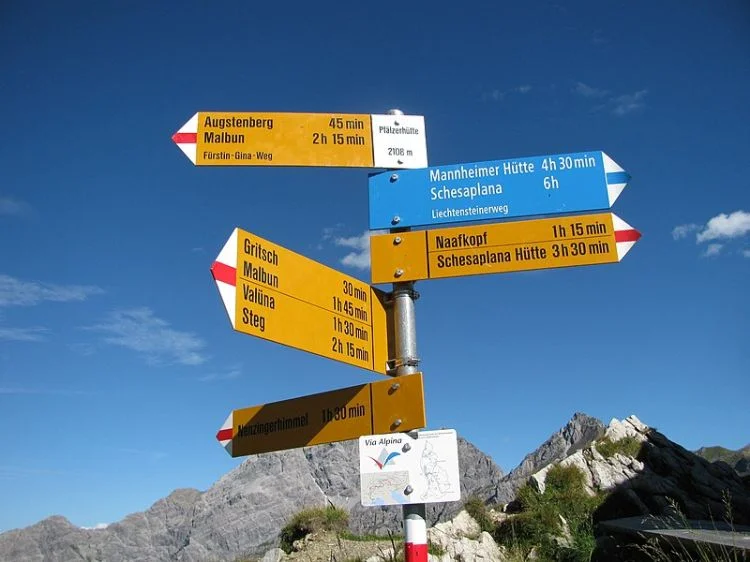
Experience a magnificent round trip hike on the Fürstin-Gina-Weg path to the Augstenberg and along the flower-filled mountain ridge along a secured mountain trail down to the Liechtenstein Alpine Association’s Pfälzerhütte, located at the base of the Naapfkopf mountain.
From Malbun we have the choice of hiking up or taking the chairlift to the mountain station at Sareis. From there, the Fürstin-Gina-Weg path follows the ridge path to the Sareiserjoch, where it runs into the ascending route from the Nenzinger Himmel and the path becomes more challenging. From here it’s uphill between alpine flowers and along small craggy paths to the highest point of the tour, Augstenberg, at 2,359 meters above sea level with a large cross on the peak and a glorious sweeping view. The following ridge path to Pfälzerhütte (hut) is challenging, sometimes steep and secured with wire ropes at exposed parts.
Those who make an overnight stop in the cozy Pfälzerhütte (hut), located at 2,109 meters above sea level, can take a side trip and climb Napfkopf the next morning to enjoy the sunrise. A broad road leads from Pfälzerhütte down to Alp Gritsch, where the route takes you between the mountain pines and the Swiss stone pines to Tälihöhi, followed by the descent back into the scenic pastures to the mountain village of Malbun. The path is named after Princess Gina of Liechtenstein († 1989), the well liked mother of today’s ruling Prince Hans-Adam II.
Tip: A worthwhile side trip is the climb up the marked footpath to Naafkopf (2,570m). To Naafkopf and back to Pfälzerhütte requires approximately 1:30 h each.
https://www.schweizmobil.ch/en/hiking-in-switzerland/route-995
Photo: ANKAWÜ
47.10263, 9.62038