Naafkopf
Back to all places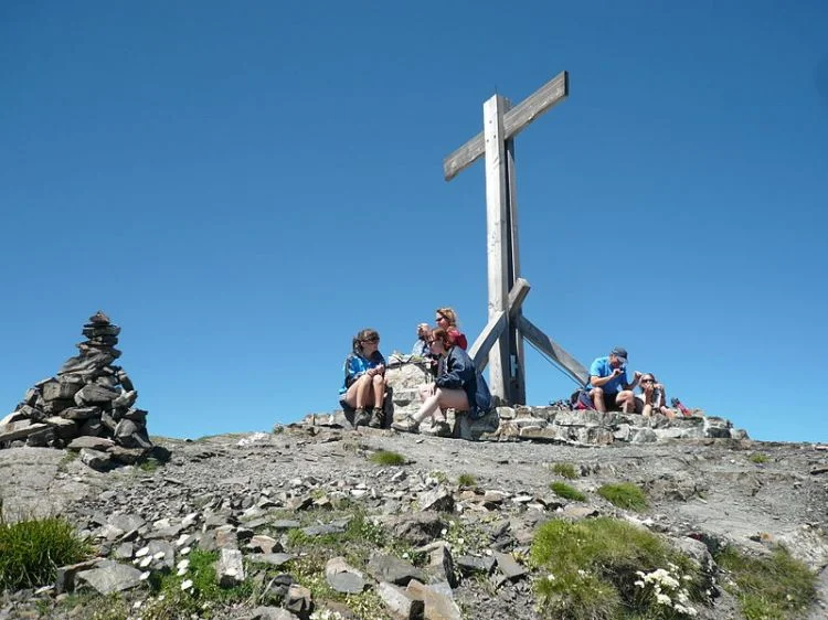
After Vorder Grauspitz (2599m) and Schwarzhorn (also called Hinter Grauspitz) (2574m), Naafkopf is the third highest peak in Liechtenstein. And where the Schwarzhorn and Vorder Grauspitz summits are already shared with Switzerland, Naafkopf is shared by still one more country: this is where Liechtenstein, Switzerland and Austria meet, right on the highest point. By Austrian and Swiss standards, 2570m is not particularly high, but nevertheless the summit views are magnificent. To the WSW, the Schwarzhorn grabs the attention. The Vorder Grauspitz is directly in line behind it, and as a result, all but its summit is hidden from view. But since they both are not much higher than Naafkopf, and not particularly bulky, they only make up a few degrees of the 360° horizon.
Of all the nearby mountains, only the Schesaplana group to the east, which is beautiful in its own right, is substantially higher and bigger. But imposing as it is, seen from Naafkopf, it still only covers a 30°arc, leaving 330° of the horizon free to see far and wide. In clear conditions, you can see for a couple of hundred kilometers to the north, deep into Germany, or as far as Piz Bernina (4049m), 80km to the south (more precisely, heading 162°).
The northeastern ridge marks the Austrian-Liechtenstein border. After 500m it turns north, and in a little more than 1km reaches the Bettlerjoch (2108m). This saddle is the location of the very nice Pfälzerhütte, one of the two refuges operated by the Liechtenstein Alpine club. The southeastern ridge marks the Swiss-Austrian border, eventually descending as low as 2292m just past the Barthümeljoch, where it starts to rise again towards the east and northeast, eventually culminating at Schesaplana (2965m), almost 8km east of Naafkopf. The Swiss-Liechtenstein border is defined by the northwestern ridge, which turns southwest after just a few hundred meters. Schwarzhorn lies 1.5 km to the WSW, and Vorder Grauspitz just over 2km. The lowest point on the ridge, Ijesfürggli, between Naafkopf and Schwarzhorn, is 2348m high, which gives Naafkopf a prominence of 222m.
The east face, in Austria, is the least steep. It’s shaped like a bowl, and is a little bit steeper near the summit. In winter, you can ski down (there is one steep step to avoid: best not to go down the center of the face but to the right or far left). The Liechtensteiner Höhenweg, a popular hiking route, traverses the east face on the route between the Bettlerjoch to the north and Barthümeljoch to the east. The south face, in Switzerland, is steep and rocky just below the summit, but a gentle bowl lower down.The north side, in Liechtenstein, has a more complex shape, with a couple of pronounced subsidiary summits and a mixture of steep and flat terrain, and impressive cliffs on the northwest.
https://www.summitpost.org/naafkopf/841116
Photo: Ramessos
47.06078, 9.60704